

Overview
Salzburg airport RWY 15 can be easily approached from the north due to flat terrain, nevertheless in this case air traffic for an Austrian airport is influencing populated areas in Germany and in addition, when doing a circling, flying over the whole city Salzburg. Approach from the South to Salzburg Airport (LOWS) is generally possible as well but with some limitations – no ILS and high mountains in close vicinity of the airport. There is a valley which is generally allowing an approach, but it doesn’t stretch along the extended runway centre line, and it is not straight either.
During suitable weather conditions a visual approach can be flown along the valley, but this depends of course on visibility and cloud base. Some alternatives are as follows:
- An RNP approach which is better than the visual approach but still has a relatively high minimum.
- An RNP AR approach which better avoids villages in the south; unfortunately, it requires RF legs (Radius Fixed Turns) in the final segment and is based on RNP AR design criteria, which makes the special authorisation necessary.
- A circling approach from the north using the ILS to RWY 15 followed by a visual circuit east of the airport with a final turn to RWY 33.
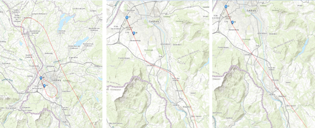
Visual display of possible alternatives
The RNP T from south was seen as a possible solution and was also the reason for conducting a feasibility study and all additional calculation, mainly noise and population count.
Another option for approach from the south is getting vectored to the north followed by an ILS intercept to RWY15, followed by a circling or visual approach to RWY33.
The main reason for the RNP AR Z to RWY33 was to provide a direct approach from the south, without the need to fly a lot of additional miles followed by an approach from the north. This is beneficial for airlines but also helps to distribute noise by reducing landings from the north. The RNP AR Z option remove at least partially arrival operations from communities.
Unfortunately, RNP AR requires special crew training, special aircraft capabilities/equipment, and an approval by Austro Control as well as from the operators’ competent authorities to use the procedure. So, if landing RWY 33 is required, many operator’ approach from the north and use the circling (overflying the city).
The RNP T from the South was just a feasibility study, after a design and the analysis, the project was stopped and will most likely not resume for various reasons.
ACG currently investigates another option that seems more promising and easier to implement.
The use case presented was part of the mentioned feasibility study which was discussed with public stakeholders where noise and population count are a significant part of the project.
As all three procedures have a common final the number of affected people in the highest noise exposure is almost identical.
IMPACT calculation provided an option to make a comparison among proposed options.
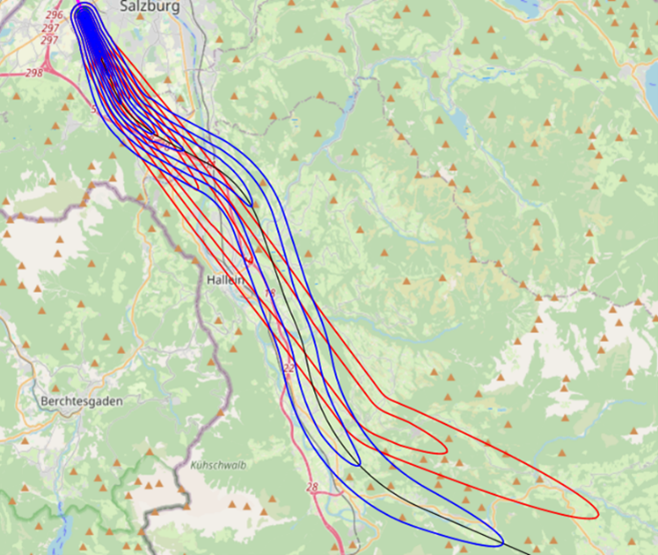
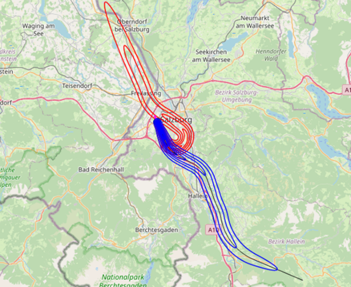
Comparison of different scenarios in terms of noise in IMPACT